
Granger, WA · Yakima County
Critical Areas Identification Form
Granger uses this form to collect site and project information from applicants proposing development or alterations that could involve critical areas.
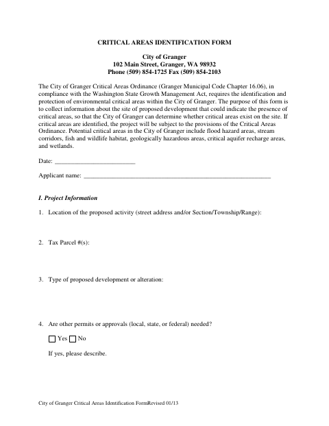
What this form is
The form helps the City of Granger determine whether critical areas may exist on a proposed development site. It asks for project location, parcel numbers, development details, site conditions, nearby water features, map indicators, and possible environmental concerns. If critical areas are identified, the project is subject to the provisions of the Critical Areas Ordinance.
Who needs it
Applicants proposing development or alterations in Granger should provide this information so the city can assess whether critical areas may be present.
How to submit it
Submit it to the city department named on the form; check the city website for current contact details.
About notarization
No notary is required; the form asks for the date and applicant name, and says to attach recorded critical-area or protection easements if applicable.
How to submit this form
- 1
Download The Form
Download the Critical Areas Identification Form for the proposed Granger development or alteration.
- 2
Complete Project Information
Provide the project location, parcel numbers, development type, applicant name, and date.
- 3
Describe The Site
Answer the site questions and mark any potential critical-area indicators that apply.
- 4
Gather Applicable Attachments
If critical areas or protection easements are recorded on the property or adjacent properties, attach them as the form directs.
- 5
Submit To The City
Submit the form to the city department named on it; check the city website for current contact details.
Frequently asked questions
- What is the Critical Areas Identification Form for?
- It collects information about a proposed development site so the City of Granger can determine whether critical areas may be present.
- What information does the form ask for?
- It asks about the project location, parcel numbers, proposed development, existing site conditions, nearby waters, map indicators, and possible signs of critical areas.
- Do I need a notary for the Critical Areas Identification Form?
- No. The form asks for the date and applicant name, and says to attach recorded critical-area or protection easements if applicable.
- How do I submit the Critical Areas Identification Form?
- The form provides Granger’s mailing address and phone and fax numbers, but no submission instructions. Check the city website for current contact details.