
Mower County, MN · Mower County
Property Adjustment Application
Mower County property owners or authorized applicants use this application to request a parcel division, combination, or boundary adjustment.
At a glance
- Issued by
- City of Mower County · Mower County, Mower County, Minnesota
- Notarization
- Not required: file this form without a notary.
- Official source
- co.mower.mn.us
- Blank form
- Download the PDF
- Catalogued
- Machine-readable
- JSON record · about the forms index
What this form is
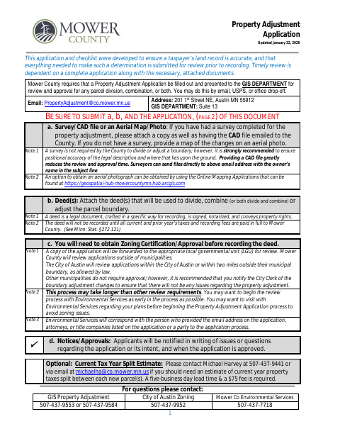
Mower County requires this application for parcel divisions, combinations, or both, and reviews it before the documents are recorded. It asks for owner and applicant contact details, existing parcel information, resulting parcel details, a reason for the adjustment, and a signature. Attach the deed or deeds and a survey/CAD file or an aerial map; zoning certification or approval is needed before recording.
Who needs it
Property owners or their authorized applicants seeking to divide, combine, or adjust a parcel in Mower County need to submit this application for review.
How to submit it
Return the application to the GIS Department by email at [email protected], by USPS, or by office drop-off at 201 1st Street NE, Suite 13, Austin, MN 55912. Allow 30 days for processing.
About notarization
This application is signed and dated without a notary; the attached deed is a separate legal document that must be signed and notarized.
How to submit this form
- 1
Download the Application
Download the Property Adjustment Application and checklist.
- 2
Complete the Application
Provide owner or applicant contact details, existing and resulting parcel information, the reason for the adjustment, and a signature.
- 3
Gather the Attachments
Include the deed or deeds and a survey/CAD file or an aerial map. Attach each resulting parcel's legal description.
- 4
Submit to the County
Return the application and attachments to the Mower County GIS Department by email, USPS, or office drop-off.
Frequently asked questions
- What is the Property Adjustment Application for?
- Mower County uses this application to review requests to divide, combine, or adjust parcel boundaries before recording.
- What should I attach to the application?
- Attach the deed or deeds for the proposed adjustment and a survey/CAD file or an aerial map showing the changes. Attach each resulting parcel's legal description.
- Do I need a notary for the Property Adjustment Application?
- No. The application is signed and dated without a notary. The attached deed is a separate legal document that must be signed and notarized.
- How do I submit the Property Adjustment Application?
- Send it to the Mower County GIS Department by email, USPS, or office drop-off at the address listed on the form. Allow 30 days for processing.