
Yavapai County, AZ · Yavapai County
Zone X As-Built Survey
This fillable survey records elevation information for a property and is completed by a land surveyor, engineer, or architect authorized to certify elevation information.
At a glance
- Issued by
- City of Yavapai County · Yavapai County, Yavapai County, Arizona
- Notarization
- Not required: file this form without a notary.
- Official source
- yavapaiaz.gov
- Blank form
- Download the PDF
- Catalogued
- Machine-readable
- JSON record · about the forms index
What this form is
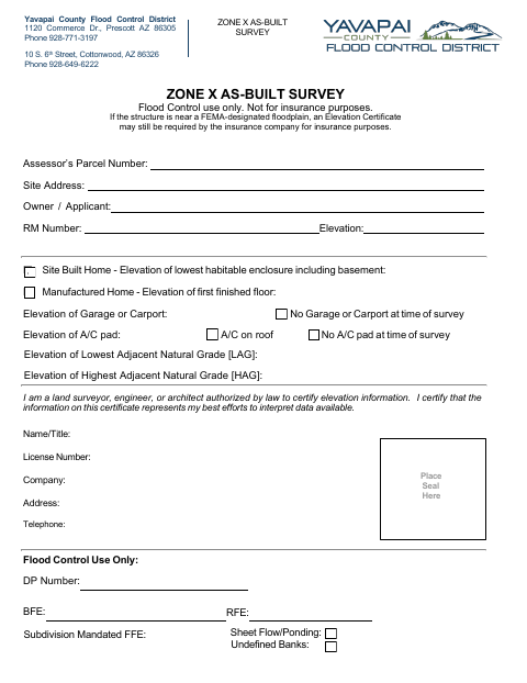
The Yavapai County Flood Control District uses this survey to record elevation information for a property in Zone X; the form says it is for Flood Control use only, not insurance purposes. It requests the parcel number, site address, owner or applicant, and elevations for relevant structures and features. An authorized land surveyor, engineer, or architect certifies the information, and the form has fields for their credentials and company.
Who needs it
A property owner or applicant needs this survey completed by a land surveyor, engineer, or architect authorized to certify elevation information.
How to submit it
Submit it to the county department named on the form; check the county website for current contact details before sending.
About notarization
This survey has no notary block; the authorized professional certifies the information and places a seal, and the document identifies no notarized attachment.
How to submit this form
- 1
Download the Survey
Download the fillable Zone X As-Built Survey PDF.
- 2
Complete Property Details
Enter the parcel number, site address, owner or applicant, and applicable elevation information.
- 3
Complete Professional Certification
Have an authorized land surveyor, engineer, or architect provide their name, license number, company, and other requested details and place a seal.
- 4
Submit to the County
Submit it to the county department named on the form; check the county website for current contact details before sending.
Frequently asked questions
- What is the Zone X As-Built Survey for?
- It records property and elevation information for Yavapai County Flood Control District use only. The form states it is not for insurance purposes.
- Who completes the survey?
- A land surveyor, engineer, or architect authorized by law to certify elevation information completes the certification and provides professional details.
- Do I need a notary for the Zone X As-Built Survey?
- No. The form has no notary block; the authorized professional certifies the information and places a seal. No notarized attachment is identified.
- How do I submit the Zone X As-Built Survey?
- Submit it to the county department named on the form; check the county website for current contact details before sending.